
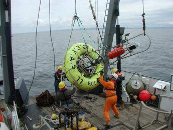
For the next three years, a network of some 20 wave-measuring buoys, floating at locations off the British coast, is to gather data on wave height and direction which, pooled together, will be transmitted to the new WaveNet database – a website that will provide early warnings to flood managers, local authorities and consultants.
The announcement came as Elliot Morley, the UK environment minister, spoke at the Oceanology International Conference and Exhibition, taking place in London today.
The UK department for environment, food and rural affairs commissioned the centre for environment, fisheries and aquaculture science (CEFAS) to develop six SmartBuoys, which are to coordinate with a range of wave measuring buoys – owned by the Met Office, Ireland’s Marine Institute and Shell and Marathon Oil – and provide real time data to the new publicly accessible database.
Morley said: ‘helped by WaveNet, forecasters will now be able to predict wave and tide heights around the country 12, 24 and 36 hours in advance and more quickly spot and act on potential flood danger.’
It is hoped that the WaveNet scheme will also provide better data for shoreline management planning and climate change studies.
To access the new database, click on the weblink below.
Related ArticlesFuture flood scenarios Computer game hailed as ‘flooding sim city’External weblinksCentre for environment, fisheries and aquaculture science


