
The Marinus Link Project is a proposed subsea and underground electricity and data interconnector connecting Northwest Tasmania with the Latrobe Valley in Victoria. Initiated in 2017 by Marinus Link Pty Ltd (MLPL), the project will unfold in two phases. Initially, MLPL operated as a subsidiary of TasNetworks, Tasmania’s transmission and distribution network service provider.
In March 2024, ownership of MLPL shifted to the Australian Government (49%), the Victorian Government (33.3%), and the Tasmanian Government (17.7%). The Australian Government provided A$75 million ($47.73 million) in funding in April 2022. In June 2020, the Australian Government designated the Marinus Link Interconnector as a Priority National Infrastructure Project.
Recommended White Papers
The project is currently in the design and approvals phase, expected to last three to four years, with a Final Investment Decision (FID) anticipated in May 2025. Phase 1 is projected to cost A$3.86 billion ($2.46 billion), with construction slated to begin in 2026 and completion expected by 2030.
Once operational, the project will supply power to 1.5 million Australian homes and create 2,800 direct and indirect jobs in Tasmania and Victoria.
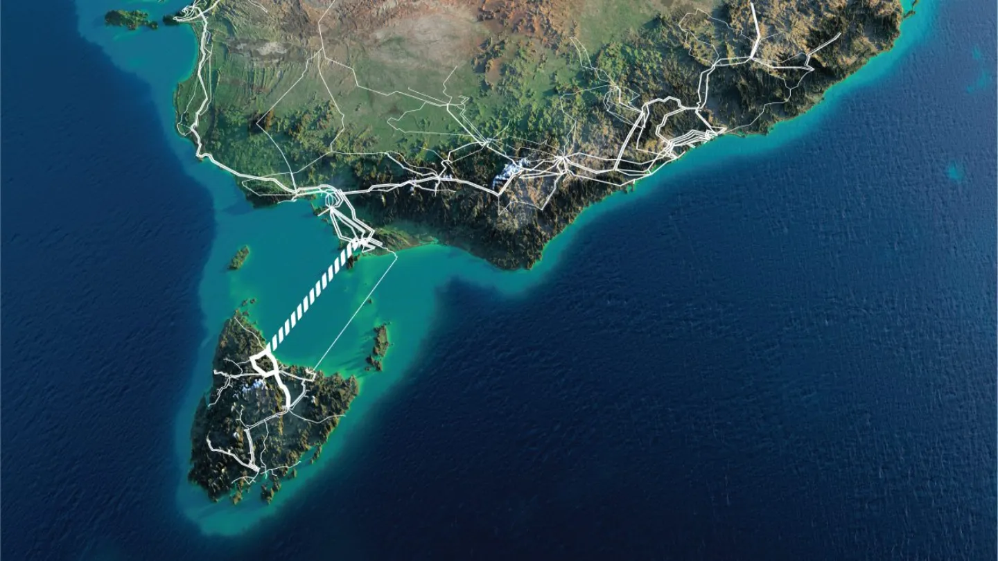
Marinus Link Interconnector Route
The Marinus Link Interconnector will originate in Heybridge, Tasmania, and traverse Bass Strait, with subsea cables running approximately 255 km north to Waratah Bay, then underground through South Gippsland to the Latrobe Valley.
Converter stations will be located at Heybridge and Hazlewood, with a communication station at Sandy Point.
The Tasmanian converter station will be near Burnie in Heybridge, while the Victorian converter station will be on Tramway Road near the Hazlewood terminal station.
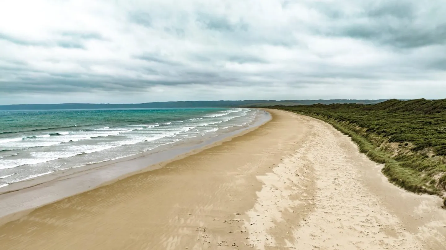
A transition station at Waratah Bay is under consideration. The Sandy Point communications station will be about 1 km from the Waratah Bay shore crossing.
Marinus Link Interconnector Infrastructure
The interconnector will use High Voltage Direct Current (HVDC) technology with HVDC Light voltage source converter (VSC) stations in the first phase. It will convert Alternating Current (AC) to Direct Current (DC) and back.
The link will feature two 750MW symmetrical monopoles using ±320kV cross-linked polyethylene (XLPE) insulated cables and VSC technology. Each 750MW circuit will consist of two HVDC power cables and a fibre-optic communications cable bundled together.
A total of 345km of cables will be developed, with 255km undersea across Bass Strait and 90km underground in Gippsland, Victoria.
Converter stations at Heybridge and Hazlewood will include High Voltage Alternating Current (HVAC) 220kV switching stations with gas-insulated switchgear (GIS), HVAC 220kV filter banks, HVAC 220/320kV transformers, and coolers.
The converter station sites will have two main buildings with HVAC phase reactor halls, valve halls, HVDC reactors, land cable terminations, and a fire water tank with a capacity of approximately 1,000,000 litres.
The Victorian Converter Station will connect directly to the 500kV yard of the Hazlewood Terminal Station.
Two land cables, each about 90km long, will link Waratah Bay to the Hazlewood Terminal Station.
The Tasmanian Converter Station at Heybridge will connect to the Tasmanian transmission network via HVAC 220kV overhead transmission lines.
Contractors Involved
In January 2025, a joint venture between DT Infrastructure and Samsung C&T, along with TasVic Greenlink and Empower (a joint venture of CIMIC, CPB Contractors, and UGL), was selected for the Balance of Works’ development phase package for Phase 1. This includes onshore civil and installation works, such as constructing converter station buildings and land cable civil works.
In August 2024, Prysmian, an Italian electrical cable manufacturer, was chosen to supply HVDC cables for the interconnector.
In May 2024, Hitachi Energy, a Swiss technology firm, was awarded the contract to supply two-way power transmission technology.
In December 2021, Marinus Link contracted MMA Offshore, an Australian marine and subsea services provider, for A$5.5m($3.50m) to conduct a Marine Engineering Geotechnical Site Investigation (MEGSI).
MMA used its survey ship, TEK Ocean Spirit, to survey 255km between Heybridge and Waratah Bay and approximately 110 sites across Bass Strait in water depths of up to 80m.