
In response to increasing demand for remote offshore services, Fugro has completed the Middle East’s first fully autonomous geophysical shallow-water route survey.
Controlled from their remote operations centre in Abu Dhabi, an uncrewed surface vessel (USV) captured a full range of geophysical data across a survey area some 40 km out from the coast of Abu Dhabi to support a client’s critical project entirely remotely.
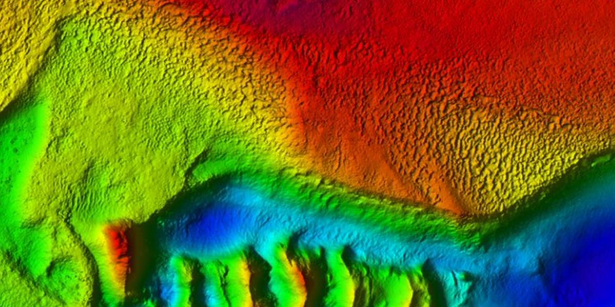
The results of the fully autonomous geophysical shallow-water route survey comprised conductivity, temperature, depth and salinity (CTDS) profiles, bathymetry data, seabed imaging, sub-bottom profiles, and ferrous object detection such as pipes etc. The efficiency gains and material reductions from using Fugro’s remote and autonomous solution, rather than a conventionally mobilised and crewed survey, included reduced HSSE exposure and significant client cost savings. Fugro’s USVs also have a much lower carbon footprint than a regular survey vessels.
“Witnessing this ambitious concept transformed into reality is a landmark moment in the Middle East that has resulted in the successful delivery of a critical seabed characterisation report based solely on our autonomously acquired Geo-data,” said Gerard Ferreira, Fugro’s Service Line Director for Marine Geophysics in the Middle East.


