Satellite analytics based on high-res satellite images emerges as a forward-thinking solution, are increasingly sought after for its profound impact on enhancing precision across different spheres, including resource management
The mining industry, in particular, has greatly benefited from satellite imagery and other forms of Earth observation data
Natural resources lay the foundation of the global economic landscape, allowing for powering everything from energy grids to industrial manufacturing. This sector, however, is currently undergoing changes to adjust to the new reality. In a world where sustainability is not just a fancy word, the industry must find ways to reach high efficiency while mitigating its ecological footprint and complying with strict regulations.
In this context, satellite analytics based on high-res satellite images emerges as a forward-thinking solution, increasingly sought after for its profound impact on enhancing precision across different spheres, including resource management. This technology not only promotes sustainable practices but also boosts operational capabilities.
Enhancing Exploration with Remote Sensing Data
In practical terms, remote sensing is crucial for numerous sectors. For instance, it aids agricultural professionals in increasing crop yields and plays a vital role in managing responses to natural disasters. In addition to the increased accessibility of satellite data, companies can now obtain satellite images for free. However, to extract valuable insights from these images, it is essential to consult with specialists.
The mining industry, in particular, has greatly benefited from satellite imagery and other forms of Earth observation data. This sector has leveraged such data for a variety of purposes including monitoring of mining sites, planning of exploratory surveys, discovery of natural resources, and surveillance of environmental conditions.
One of the primary uses of high quality satellite images in mining involves the exploration for new resources through scanning for geological signs that are typically associated with specific minerals. Satellite imagery also enables mining companies to precisely focus their exploration efforts, improving both cost-efficiency and effectiveness. Moreover, geospatial analysts utilize these images to map out the mineral distribution within a region. By integrating satellite data with other information like geological surveys, mining companies gain a richer understanding of the area’s geological makeup. This knowledge aids in pinpointing prospective sites for exploration or extraction and helps in optimizing mining operations by revealing areas that might be saturated with competing interests.
Use of remote sensing in the mining industry
Remote sensing via satellite technology is profoundly transforming the mining industry by facilitating operations throughout all stages of the mine site lifecycle.
At the forefront, satellite imagery significantly aids in the prospecting of mineral deposits. These images not only provide critical information about the terrain, such as roads, trails, and barriers, but also form the basis for creating detailed land cover maps. This is crucial for identifying potential access routes to exploration sites and assessing the environmental impacts of major projects.
In regions like Europe, where high-quality mines are nearing depletion, the challenge shifts to locating new deposits in remote areas. Here, satellite-based remote monitoring becomes invaluable, offering a faster, more efficient means of conducting geological explorations in inaccessible locations.
Satellite maps are essential for identifying visible rock layers and monitoring vegetation health in areas under exploration. They also play a pivotal role in monitoring open-pit mines during the extraction phase. For instance, radar imagery from satellites like Sentinel 1 is analyzed to observe slope stability and monthly changes in landscape where active mining occurs. This monitoring is vital for ensuring worker safety by promptly identifying and addressing potential hazards before they lead to accidents.
Moreover, multispectral satellite images are crucial for the renaturation of lands post-mining. These images allow for the continuous monitoring of vegetation and the management of issues like acid drainage, which is the outflow of acidic water from mines. The high-resolution data helps track the response of vegetation to stress, enabling more effective renaturation management. These images are also invaluable for assessing the potential for farming and other activities on reclaimed mining land.
Enhancing Mineral Deposit Mapping with Satellite Imagery
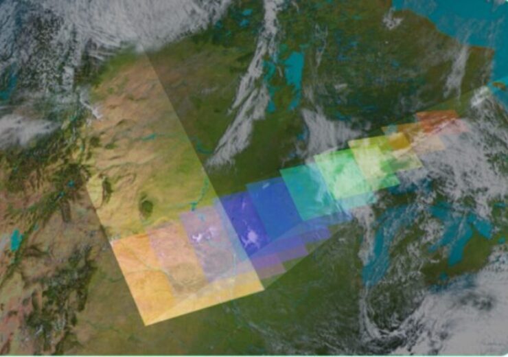
Satellite imagery excels in mapping areas with potential mineral deposits by leveraging the unique spectral signatures of over 4,000 known minerals on Earth. These signatures, much like human fingerprints, are distinct for each mineral and can be identified from space. Satellites measure subtle variations in electromagnetic wavelengths caused by the minerals’ chemical compositions to detect these signatures.
Advanced imaging technologies capture data beyond the visible spectrum, including infrared and short-wave radiation, which are instrumental in revealing structural features of the Earth’s surface. Through thematic mapping and spectral images, researchers can gather detailed information about the absorption and reflection properties of soils, rock compositions, and vegetation coverage. This data is critical for identifying clay deposits, oxide levels, and soil types, further enhancing the efficiency and effectiveness of mineral exploration efforts.
Monitoring Environmental Impact
Satellite imagery has become a vital resource for assessing the environmental consequences of mining activities and facilitating reclamation initiatives. The increasing capabilities of high resolution satellites have enhanced our ability to oversee vast mining areas. These images are key to identifying and measuring vegetation loss, changes in land use, and pollution sources like acid mine drainage, allowing us to track contamination spread effectively.
Moreover, comparing before and after images helps evaluate revegetation projects and assess the long-term stability of mine tailings dams. Utilizing this data enhances the sustainability of mining practices and helps mitigate their environmental impact. Let’s see how that works by taking Australia for an example.
Gas Mining Effects On Farmlands
Australia, rich in unconventional gas reserves such as coal seam gas (CSG), faces a critical environmental dilemma. The accelerated extraction of CSG has led to soil subsidence, severely damaging vast tracts of agricultural land, particularly in Queensland where over 20 million hectares of farmland are jeopardized.
In response, the Australian government has adopted an adaptive management strategy to counteract these environmental hazards. This proactive approach includes stringent monitoring of environmental impacts and enforces corrective measures when adverse effects surpass predefined thresholds, particularly concerning groundwater drawdown.
Unfortunately, current legislation provides for compensation to affected landholders only within designated mining areas, posing a challenge for those experiencing damage beyond these boundaries.
While optical satellite data analytics offers limited direct observations of CSG impacts, it proves invaluable in tracking related phenomena, such as changes in soil moisture. Through platforms like EOSDA Crop Monitoring, landowners can utilize the Normalized Difference Moisture Index (NDMI) to detect increased soil moisture indicative of subsidence. By comparing these findings against traditional hydrological models, subtle yet significant alterations in drainage patterns and moisture accumulation can be identified, though linking them conclusively to CSG activities remains complex and outside current optical satellites analytical capabilities.
Progress Tracking
High resolution earth images offer a panoramic view into the operations of mining sites, providing pivotal data that maps the rhythm of production and shapes the logistics of the supply chain. This technological advantage allows for a precise overview of daily developments, granting operators the ability to monitor real-time progress, track the equipment, and observe ongoing activities with a goal of increasing efficiency and fine-tuning production outputs.
For example, operators harness satellite imagery not just for general surveillance but to meticulously oversee the day-to-day operations of mining sites. This includes the agile tracking of equipment movement and activity, essential for enhancing operational efficiency and maximizing production potential.
Moreover, satellite data plays a crucial role in quantifying the volume of minerals extracted. This information is instrumental in helping operators predict the lifespan of mining sites, schedule closures, and strategize remediation efforts, ensuring responsible management and environmental compliance.
The escalating reliance on satellite analytics within the natural resource sector underscores the industry’s pursuit of innovative solutions to navigate its operational complexities and environmental footprints. As satellite technology progresses, it becomes increasingly integral to resource extraction by promoting greater efficiency, safety, and sustainability. This evolution is poised to revolutionize natural resource management, heralding a new era marked by heightened efficiency and enhanced stewardship.